
Follow a Champlin Street Trail
An address-led Champlin search begins with the property, not a name list. Hennepin records can link a street address to a parcel and a 13-digit PID, then to the legal description, sales information, map context, and recorded land trail. That sequence can identify sources that document an owner, taxpayer, recorded party, subscriber, or household at a particular date. None of those labels is interchangeable with the word occupant.
- Enter the standardized address in PINS, then save the PID, addition, lot, block, and visible property details.
- Open the same parcel in Hennepin GIS to check its map position, adjoining parcels, road gaps, and subdivision context.
- Search RecordEASE by the legal-description or party trail and record each deed or other instrument separately.
- For an older household question, inspect the relevant dated directory, census, map, or newspaper rather than assuming the parcel record names every person.
- Use city permits or a precise data-practices request only as an address-and-date lead, then note the classification and record purpose.
Start over with the next address rather than treating a whole block as one record. Parcels can split or merge, a road right-of-way can interrupt apparent adjacency, and a title chain can differ from a household's history.
Set Up a Champlin Address
Normalize each Champlin address before using a county portal. Include the number, directional prefix or suffix, street type, unit, city, Hennepin County, and postal ZIP. The verified postal ZIP is 55316, but ZIP is a delivery-routing label rather than a legal boundary. Use the USPS address lookup for postal formatting and Hennepin PINS or GIS for county and municipal context. Older materials may use a rural route, legal description, Champlin Township, or Village of Champlin instead of a modern street number.
Keep a separate note for the situs address, which is the property location, and any taxpayer or mailing address. The taxpayer mailing record can point outside Champlin and does not transfer title. For a street-directory search, the most stable bridge is usually the PID plus the legal description, not a spelling variation in a street name.
Note: The county's property database accepts PIDs with dashes or spaces, but preserve the exact format that the official result returns.
Search Champlin PINS by Street
Hennepin PINS offers three documented ways to reach a Champlin parcel: address, PID, and addition. Address mode needs a house number and street name, with a unit field when needed. County search tips recommend at least three characters for the street name. PID mode requires all 13 digits. Addition mode accepts an addition name and can be narrowed with a lot or block, which helps when a modern street address is not the best historic search key.
| PINS field or mode | Entry rule | Street-directory use |
|---|---|---|
| House number and street name | Required in address mode; unit optional | Finds the current parcel lead. |
| PID | All 13 digits; spaces and dashes accepted | Anchors the parcel across property and map work. |
| Addition, lot, block | Addition name required; lot and block optional | Helps connect a plat or subdivision to the address. |
| Records per page | Optional result setting | Controls display, not a bulk-download tool. |
The Hennepin PINS address, PID, and addition search is the source for the following interface image.
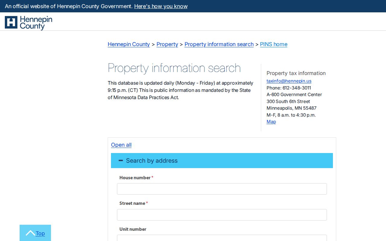
PINS documents assessment and tax categories, parcel descriptions, sales, and recently recorded history. It updates each weekday around 9:15 p.m. Central Time. The county prohibits multiple-parcel downloads and automated extraction, so use individual records and the county's own contact path for larger or unclear requests.
Champlin Address Record Layers
Different address-keyed records answer different parts of a street question. Property data connects a site to a parcel. GIS adds spatial context. Recorded land documents show transactions or interests. A city file can establish that a municipal process occurred at a date. Historical directories and census schedules can describe a household snapshot. Voter data has statutory limits and is not a street-by-street public roster.
| Address record | Street key | What it can show | Access and limit |
|---|---|---|---|
| PINS | Situs address, PID, or addition | Parcel description, assessment, sales, and recent record lead | Online; property record does not establish an occupant. |
| Hennepin GIS | Address or PID map context | Parcel geometry, street and adjoining-parcel context | Dynamic viewer; map proximity is not personal identity. |
| RecordEASE | Legal description or parties | Grantor, grantee, instrument, and recording chain | Limited entry online; images and tools can be gated. |
| Champlin permit or city file | Address and project date | Application, project, inspection, or request lead | No public historic address-search portal was located. |
| Directory or census | Street, number, name, and year | Dated subscriber or household context | Coverage and indexing gaps apply. |
Use the date and label from each source in the notes. A taxpayer, deed party, phone subscriber, permit applicant, and census household head may all be different people. That distinction is the core safeguard in a useful address trail.
Read Champlin Address Labels
Property terms are easy to overread. The site address shown in PINS is the situs address. A parcel is the defined property unit, usually tied to a PID and legal description. A plat is a recorded map or subdivision document that helps connect lots and blocks to a street pattern. A taxpayer is the party receiving a tax record, while the recorded owner comes from a deed or Torrens record. Neither label alone proves that a person occupies the property.
- Situs address
- The physical property location used to find the parcel.
- Parcel
- A defined property unit with a county identifier and legal description.
- Plat
- A recorded map showing lots, blocks, or subdivision layout.
- Criss-cross directory
- An address-arranged directory format when an edition includes a reverse street section.
The Hennepin taxpayer-name and mailing-address form is the source for the following image.
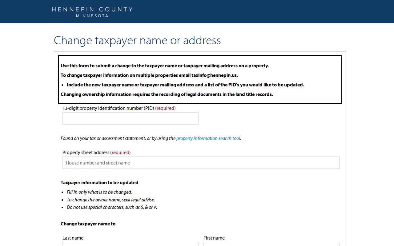
The form shows separate fields for PID, property address, taxpayer name, and mailing address. Its instructions state that an ownership change requires recorded legal documents, so it should never be used as a title or occupancy shortcut.
Follow Champlin Deed Records
After PINS supplies the parcel clues, move to RecordEASE and search the legal description, PID-related reference, or recorded parties. For every relevant instrument, preserve the document type, recording date, instrument or document number, parties, legal description, and image or copy status. A parcel can have multiple instruments, easements, split or merge history, and registered-land references. The first deed found is not automatically the first owner or the first household connected with the address.
The free RecordEASE entry is limited. County research notes identify RecordEASE Pro as the broader subscription route and the Research Center kiosks as an in-person option. The official pages did not verify a complete public field list or online start year. When older material is needed, use recordeasehelp@hennepin.us, RecordingInfo@hennepin.us, recordsrequest@hennepin.us, or the recorder's 612-348-5139 line to confirm the best channel before ordering.
The Hennepin RecordEASE Public Search is the source for the following land-record interface image.
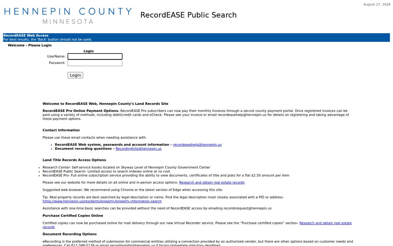
Use a recording date as a filing marker. Pair it with the next recorded instrument, a dated directory, or a census record before drawing a conclusion about a household along the street.
Map a Champlin Street
Hennepin County GIS Property Map turns the address and PID into a parcel view. Select the target parcel, copy the PID or legal-description reference when shown, then use the map to identify adjoining parcels, street names, subdivision context, road features, river or park context, and possible split patterns. For each adjoining parcel, repeat the PINS, RecordEASE, and map sequence. A map can tell you which parcels touch or sit nearby, but it does not identify a household or relationship between people.
GIS layers and tools are dynamic, and the research inspection did not verify the complete layer menu, export behavior, or every adjoining-parcel field. For historic physical context, the Hennepin County Surveyor offers aerial prints for 1975, 1979, 1985, 1989, and 1994, as well as maps and custom orders. An aerial can date a visible structure or street pattern, not the person connected to it.
Note: Mark uncertain parcel splits, road gaps, and old address forms instead of forcing them onto a modern map without a plat or custodian confirmation.
Date a Champlin Street
City permits and public-works material add dates to an address trail. Champlin's online permits page lists building, electrical, signage, mechanical, contractor, engineering, business, and police permit categories, but it is an application path rather than a public historic address-search index. The Building Inspections Division accepts online and paper applications and directs permit questions to 763-421-2629. For an older city file, use the responsible city department or a targeted Chapter 13 request with an address, date range, and record type.
Current project records can also preserve street history. The 2026 Street & Utility Project describes about 2.5 miles of residential streets built between 1967 and 1994, with construction from May through September 2026 and linked project maps, phasing, assessment material, and public-meeting documents. A project letter or application contact is not a resident list and should not be presented as one.
The Champlin Online Permits page is the source for the following city interface image.
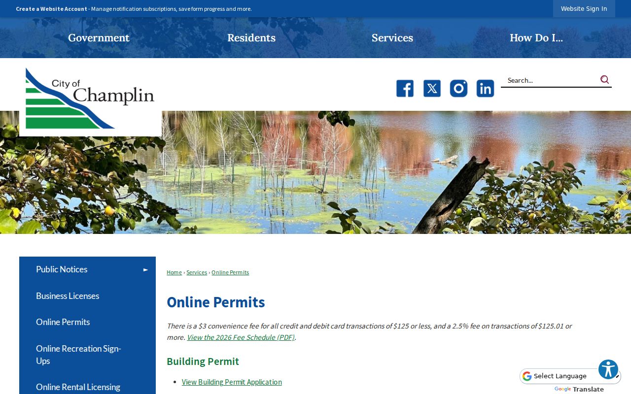
Permit, code, and project records can be useful date markers for work at a property. They need their own classification review, and an applicant or contractor should not be assumed to own or occupy the address.
Champlin Street Names Before 1971
Older address research often runs into a jurisdiction change before it reaches a street-name problem. The state boundary record shows a 5,602-acre consolidation from Champlin Township to the City of Champlin, approved March 18, 1970; the city's history places consolidation of the Village and Township in 1971. Search those earlier labels in census, directory, deed, plat, and farmers-directory material. A legal description can be more durable than a numbered address from a period before the current city form.
No official Champlin street-renumbering or street-renaming chronology was located in the research. Preserve the original wording from each directory or deed, then ask Champlin Engineering or Public Works when a historic number does not resolve. The official city routing page gives 763-451-1955 for address, engineering, map, and street questions. For the historical shelf itself, a dated full telephone directory is more useful than a Yellow Pages-only issue, which may document businesses rather than households.
Champlin Street Voter Limits
Minnesota voter information is not a block roster. The statutory public information list has defined fields and use rules, while the state status tool is for a person checking their own registration and polling information. A lawful voter-list request requires registered Minnesota voter status, photo identification, a permitted use certification, and compliance with restrictions on transfer and searchable online publication. Hennepin-specific election data requests go through the county data portal.
Use election records only for their lawful, limited purpose. A precinct, district assignment, or dated list entry does not establish who currently occupies a Champlin property. Safe at Home protections and private election data make it especially important not to reverse-engineer or publish address information through a street-level search.
Limits of Champlin Street Records
An address-record trail for Champlin can organize public research, but it cannot reliably identify everyone who lives along a road. Parcel records are not a universal household list. Taxpayer and mailing fields may point elsewhere. Deed parties document land interests, directories can omit people or cover only a subscriber, and census records are dated snapshots. Court, city, voter, and vital records also have their own access rules and protected fields.
When a fact remains uncertain, label it as a property record, recorded document, directory listing, census entry, or city-file lead and verify it with the custodian. City requests go through the Champlin data-practices contact; county property, land, election, and court questions should go to their respective offices. That preserves a useful public trail without overstating what an address record can show.